"SDTS" is a container file format used by the USGS for its GIS data. For this project these data sets are used to build the base layers for the trail maps.
| Page Contents |
The SDTS data are organized corresponding to the USGS's 7.5 min and 15 min topographic maps. For each topographic map the SDTS data are divided into two distinct types of data sets.
DEM
As an example the SDTS DEM file for the Glasgow 7.5 min topographic map is
1694514.DEM.SDTS.TAR.GZ. The "TAR.GZ" suffix marks this file as a compressed
archieve file that when open contains the individual files:
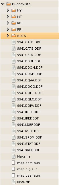
| 9941CATD.DDF | 9941DDOM.DDF | 9941DQHL.DDF | 9941IREF.DDF | 9941STAT.DDF |
| 9941CATS.DDF | 9941DDSH.DDF | 9941DQLC.DDF | 9941LDEF.DDF | 9941XREF.DDF |
| 9941CEL0.DDF | 9941DQAA.DDF | 9941DQPA.DDF | 9941RSDF.DDF | |
| 9941DDDF.DDF | 9941DQCG.DDF | 9941IDEN.DDF | 9941SPDM.DDF |
The starting point for this set is the 9941CELO.DDF file.
DLG
The DLG files for the same Glasgow topo are: 1174412.HY.sdts.tar.gz for hydrographic
data and, 1204942.RD.sdts.tar.gz, 1386980.HP.sdts.tar.gz, 1204819.MT.sdts.tar.gz,
1205062.RR.sdts.tar.gz for roads and other "transportation features". Each of these again
unpacks into a large number of files. It is recommended to unpack each of these into its own
sub-directory.
The data type, archive file, and starting points are sumerized in the table.
| Data Type | Archive Container | Starting File |
|---|---|---|
| Elevation | 1694514.DEM.SDTS.TAR.GZ | 9941CEL0.DDF |
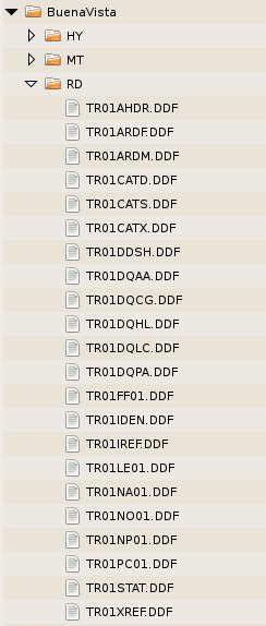
| Roads | 1204942.RD.sdts.tar.gz | RD/TR01LE01.DDF |
| Utilities | 1204819.MT.sdts.tar.gz | MT/TR01LE01.DDF |
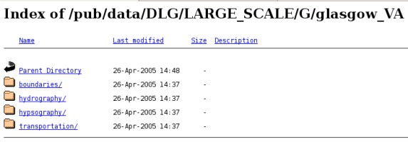
The DLG data for the 1:24,000 scale maps are available on-line directly from the USGS. The site has tree of links descending to levels of finer detail:
DEM Data Source
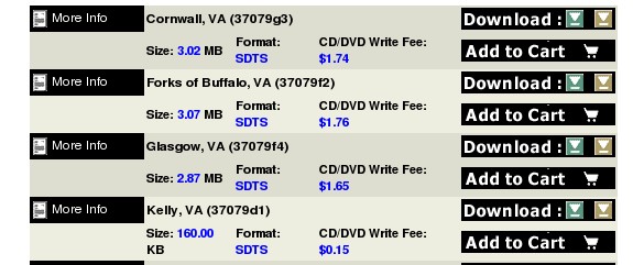
The DEM data is a little more complicated becuase the USGS has contracted with comercial vendors who
distribute the data both as a free services and as a value-added, for-fee service. The free downloads
come with the requirement of signin onto there mailing list. The current comercial
vendors are:
Using the server geo community, the path to the data selection is
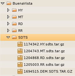
The images below show a typical orgainization of the complete data set for a given map, Buena Vista in this example.
| STDT Tar Files | Data set folder | Road Sub-folder |
|---|---|---|
 |
 |
 |